

Maps
I love maps. I love looking at maps. I love creating maps. I love aerial perspectives and cartoon maps. If you’re a hiker and wildflower lover, you might have seen my map in Russ Jolley’s Wildflowers of the Columbia River Gorge.
Let me know if you need an easy-to-understand map.

Rainbow Water System Map The Rainbow Water District serves Lane County residents who live just outside the Springfield city limits. This stylized map shows the utility’s water supply system and the location of important features. This was featured in their annual report. I designed that too!

ODOT ARTS Project Map I drew this map of improvements planned for OR 35, OR 281 and OR 282. The challenge was fitting the entire length of OR 35 from Hood River to the southernmost project area on Mt. Hood. My solution was to draw inset maps that were blown up to show the detail of two areas. Took several attempts to figure this one out!
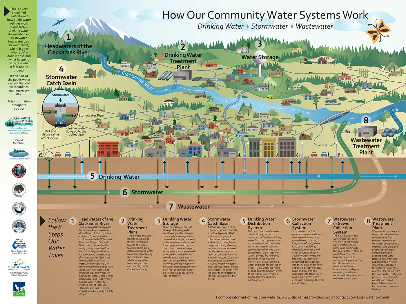
Our Community Water System for Clackamas River Water Providers I conceptualized and designed and drew this entire map, including all those little houses. It was done for school kids but saw a much wider use because of its comprehensive look at the water systems, starting near Mt Hood and continuing down to the Willamette River.
Original conceptual design and creation
Original drawing
Layout of the entire piece
Print coordination
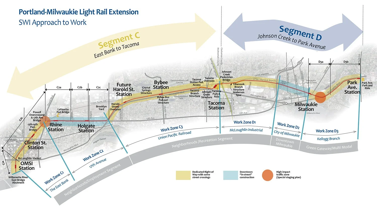
Approach to Work Map for the Portland-Milwaukie Light Rail Extension I worked with Stacy and Witbeck to develop this map outlining the work zones for this Portland project.
Original layout and design
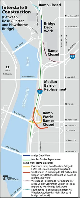
ODOT Map I drew this map to illustrate the ramp work on the east end of the Morrison Bridge. Simple but effective map!

Willamette Water Supply This is more of an infographic really, showing the new water supply for these suburban communites, Hillsboro, Tualatin, and Beaverton. A mammoth, multi-year project to ensure the long-term availability of quality water. BIG project.

Canyon Road Streetscape Map For ODOT, this shows the project areas for an improvement project in Portland. I also designed the logo for this project.
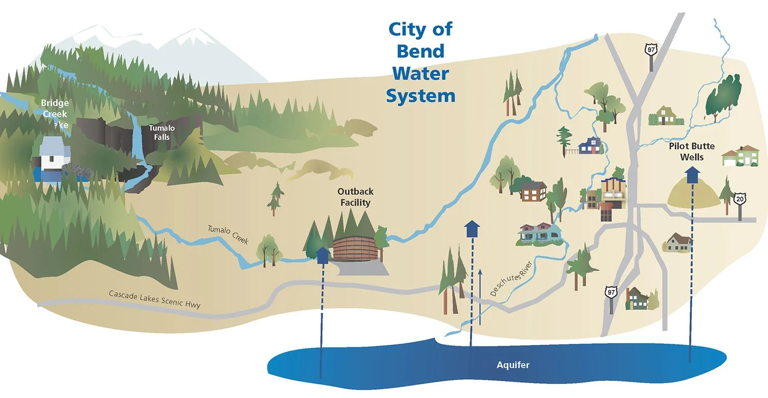
City of Bend Water System Illustrative Map I used to call these bird’s eye perspectives, I guess anymore they’re aerial perspectives but I still like the idea of seeing it from the bird’s eye, like in that great Alfred Hitchcock movie The Birds. This was done for Barney and Worth, many years ago, but as with most of my work, I still like it.

Confluence Project Site Map Confluence is a multi-installation arts project that celebrates the indigenous population along the Columbia River, from Lewiston to its mouth at Astoria. This map shows each installation.

Fort Vancouver Map This is part of the brochure for Ft. Vancouver, the map had to follow the design standards for the national park system.


Ventura, California Map ThI did both of these aerial maps for Water Systems Consulting, to show a water reclamation facility, water treatment plant siting, and water lines for this Southern California site.

Simple Segment Map This is a project along the Oregon Coast.

Boundary Hydroelectric Project Brochure This is a tabloid sized map that is printed on a pad so you can tear off one of the maps. This dam is way way up north in Washington, the Canadian border is on the left edge of the map. I reoriented the map to a horizontal layout; the original was vertical. It took some finagling. The info below matches the already established design guidelines but required some creativity on my part to fit it.
Reorient map
Create easy to read layout
Rename and renumber map